Multiple Systems
Operators switch between CCTV, fire alarms, GIS, sensors and communication platforms.

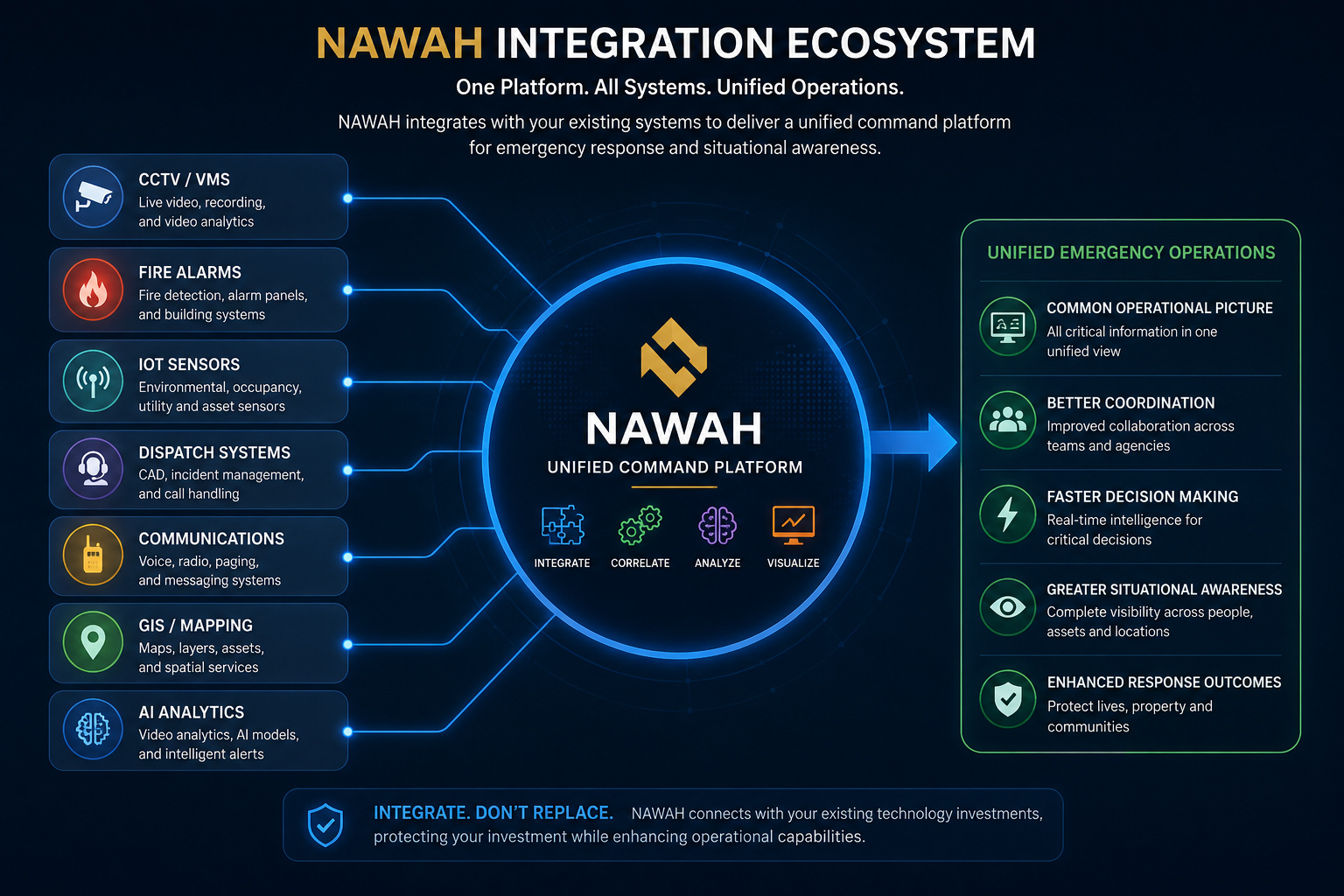
NAWAH brings together video, alarms, sensors, GIS, AI and operational workflows to help emergency-response organisations detect incidents earlier, verify situations faster and coordinate response from a unified operational environment.
Emergency organisations often already have capable CCTV, fire alarm, GIS, sensor and communication systems. The challenge is that these systems can operate independently, forcing operators to assemble the operational picture manually during critical incidents.
Operators switch between CCTV, fire alarms, GIS, sensors and communication platforms.
Manual verification can increase the time required to establish what is happening and make dispatch decisions.
False alarms can consume valuable resources and reduce operational efficiency.
Critical information is distributed across separate systems rather than presented as one operational view.
NAWAH is designed to integrate existing operational systems into a unified environment — bringing together the information operators need without requiring organisations to replace their current technology investments.
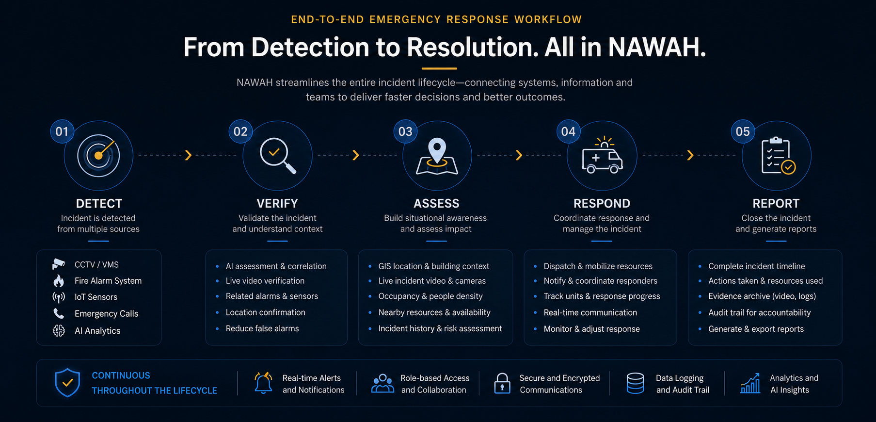
Instead of treating every event as an isolated alarm, NAWAH can bring detection, context, operator verification and response actions into a coordinated incident workflow.
An event can originate from CCTV, a fire alarm, an IoT sensor or another connected source.
AI assessment, related events and live video give the operator context to confirm the incident and help reduce false alarms.
NAWAH brings together the incident location, nearby camera views, occupancy information and available operational context.
Once verified, operators can coordinate response actions, monitor the incident and track progress through the same environment.
Actions can be recorded for incident reporting, evidence archiving and a complete audit trail.
NAWAH can consolidate live video, location, surrounding context and incident status so that operators do not need to switch between multiple applications during an emergency.
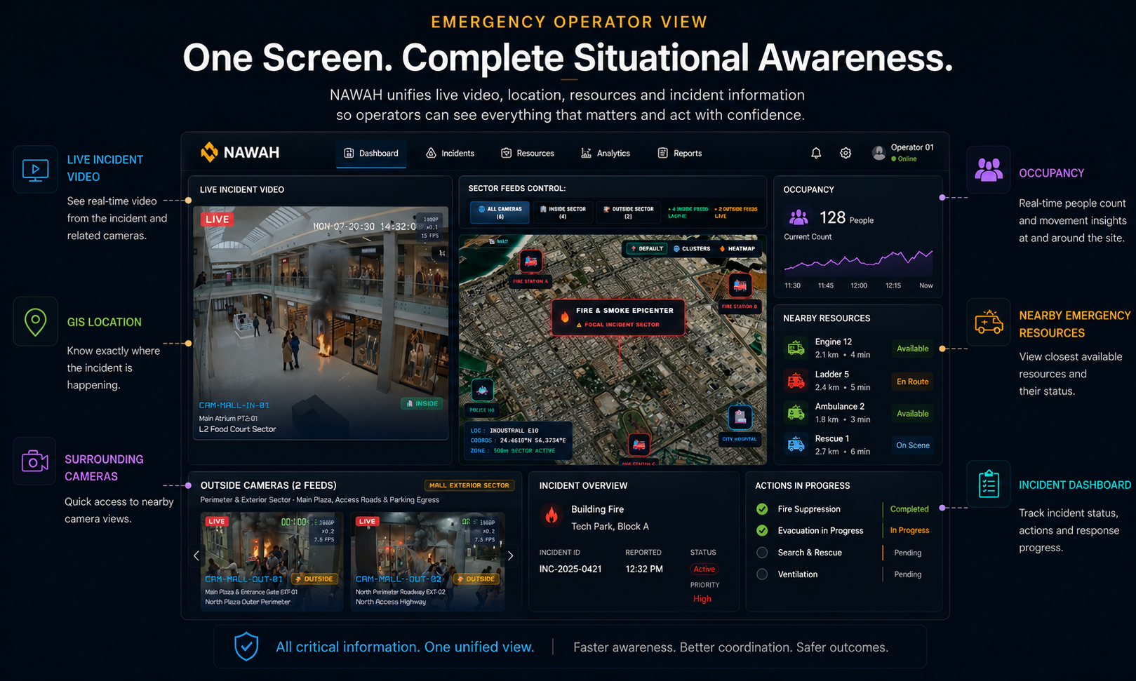
View the incident in real time.
Pinpoint the exact incident location.
Access nearby cameras for additional context.
Monitor people count and movement around the incident.
See relevant response resources where integrated.
Track incident status, actions and response progress.
NAWAH can bring together AI analytics, Vision Language Models, sensor data and information from connected systems to help operators detect, understand and assess emergency situations more effectively.
Analyse CCTV streams for visual indicators of smoke or flames to support earlier detection.
Monitor crowd density and occupancy levels to support situational awareness and evacuation management.
Support evacuation headcount verification at designated assembly areas.
Identify unusual activities or events that may require operator attention.
Combine information from video analytics, VLM, sensors, alarms and connected operational systems to create a more coherent and comprehensive view of the ground situation.
Develop and integrate analytics based on customer-specific operational requirements and use cases.
AI capabilities shown are representative use cases. Final analytics, models and performance depend on the configured deployment, source data and customer requirements.
Traditional video analytics are effective at detecting predefined objects, events and behaviours. Vision Language Models can complement these analytics by interpreting the wider visual scene and providing contextual information about what is happening, what may be important and why it requires attention.
Within NAWAH's emergency operations environment, VLM can work alongside video analytics, alarms, sensors and other operational data to support faster assessment and information fusion — helping operators move from individual detections towards a more complete understanding of the situation.
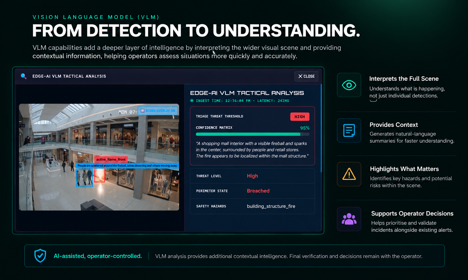
AI-assisted, operator-controlled. VLM provides additional contextual intelligence to support operator assessment and decision-making. Final incident verification and operational decisions remain with the authorised operator.
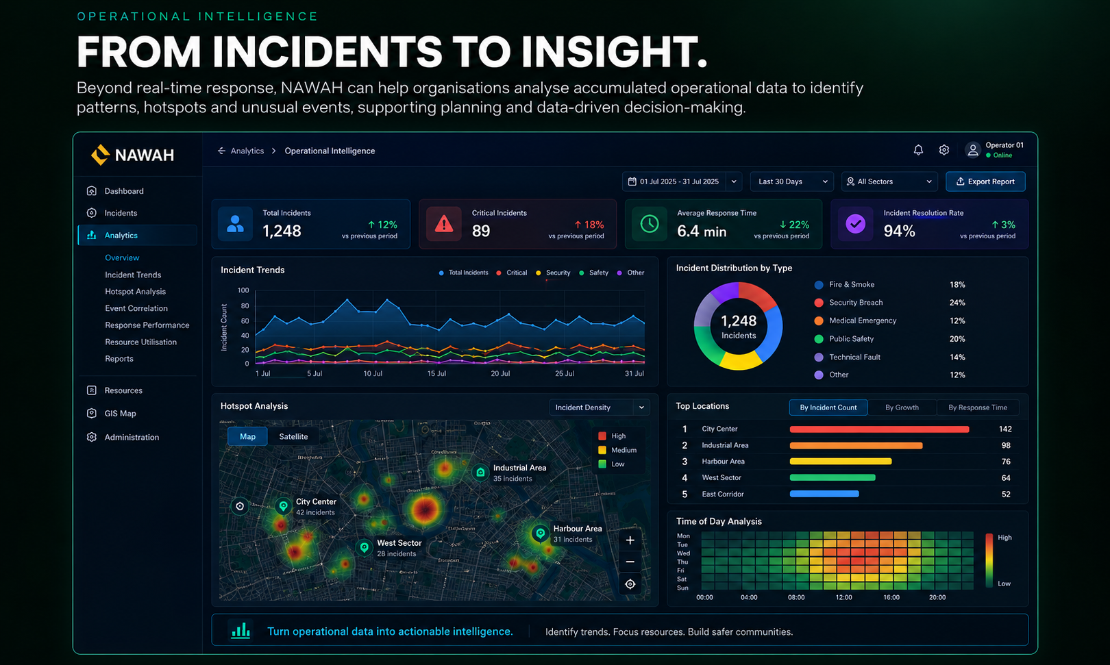
Beyond real-time response, NAWAH can help organisations analyse accumulated operational data to identify patterns, hotspots and unusual events, supporting planning and data-driven decision-making.
Identify recurring operational patterns over time.
Visualise incident hotspots and high-risk locations.
Highlight unusual events or behaviours for attention.
Use historical data to support forecasting and resource planning.
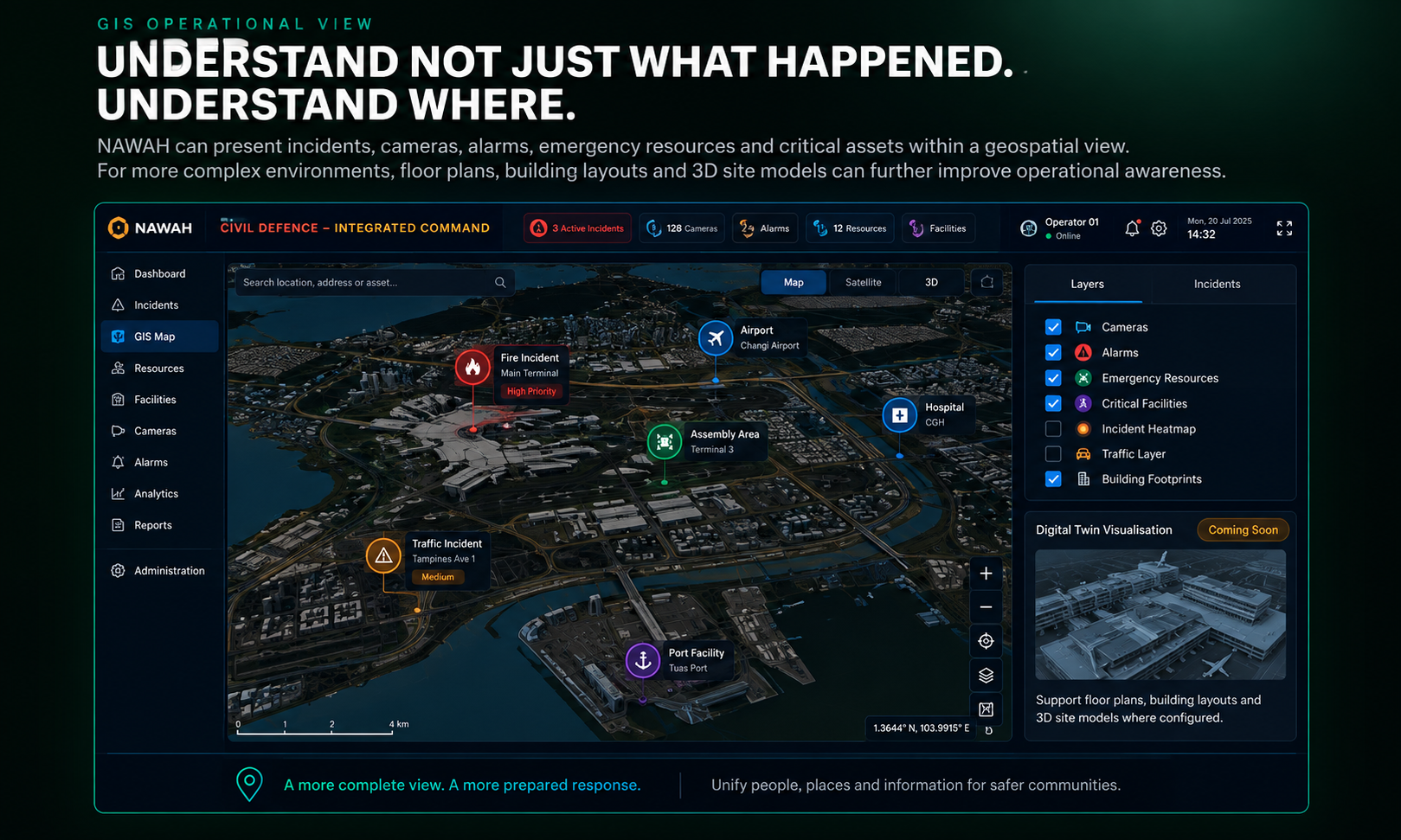
NAWAH can present incidents, cameras, alarms, emergency resources and critical assets within a geospatial view. For more complex environments, floor plans and building layouts can further improve operational awareness. Digital Twin visualisation is planned as a future capability.
By connecting systems, information and workflows, NAWAH is designed to help operators understand incidents faster, coordinate actions more effectively and maintain a complete operational record.
NAWAH can be configured around customer workflows, systems and operational requirements, providing a flexible foundation for unified emergency operations.